by the 3rd Armored Division

After reading the historical article entitled "Spearhead in the West", G-3 SUPPLEMENT, SEINE TO SIEGFRIED LINE on the 3rd Armored Division History Website , I wanted to find out where the breach was made.
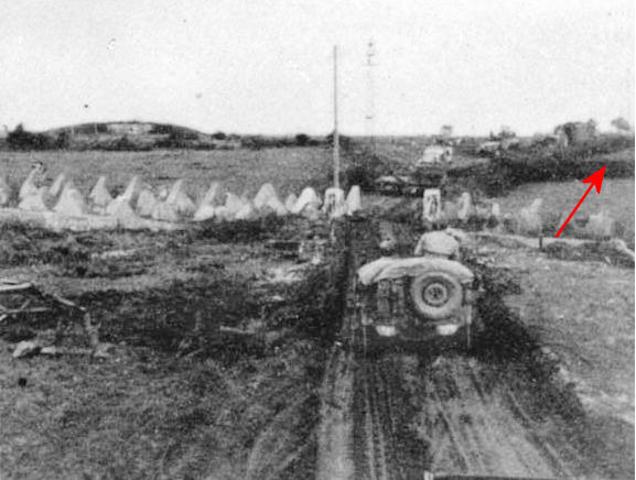
The 3rd Armored Division History Website has on it site several photos by Marvin Mischnick, which was the 3rd Armored Division 1941-45, Headquarters Photographer.
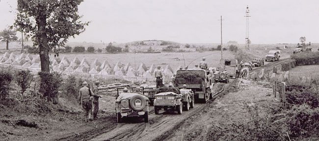
Picture courtesy of Marvin Mischnick - US Army
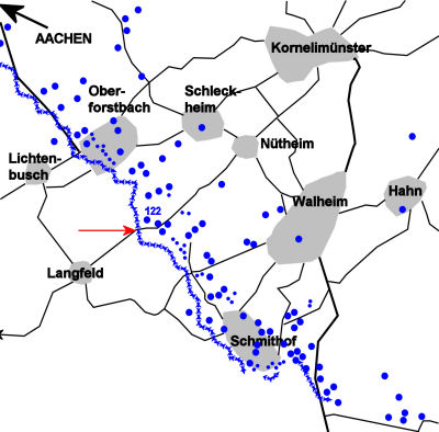
In the historical text one can read that the C.P. was in Langfeld and that the tanks were on the move in an eastward direction towards Nütheim.
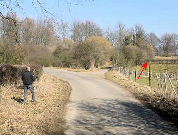
Armed with this information, my friend Frans and I went off to take a look at the terrain.
After studying several topographic maps and viewing aerial photos of the area in Google Earth, I'm almost certain we've found the spot where Mischnick took the above picture of the Siegfried Line.
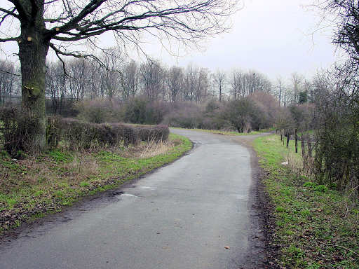
It's obvious that the area has dramatically changed over the years.
Some remarks on what has changed:
- In the background one can see the road "Monschauer Strasse (L233)"
which is post war and built on a 8 foot high road bank.
For this reason one cannot see the background as it appears in Mischnick's photo. - Nowadays the road surface is asphalted and bends left towards a tunnel
underneath the Monschauer road.
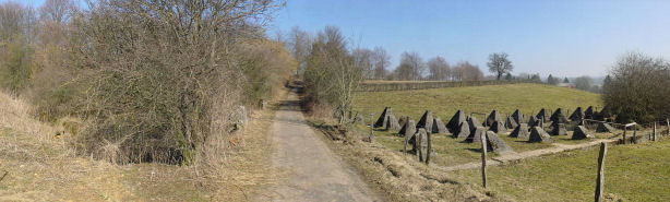
The old track through the passage of the dragon's teeth bends to the right. - The dragon's teeth left of the passage are not visible because of shrubs.
- Although a bit bigger, the oak at the left is still there. Even the low hedgerow at the left follows the same path.
- In Mischnick's photo there are 5 vehicles in between the oak tree and the front of the teeth. My friend Frans and I have carried out some measurements and the distance seems to fit.
- In Mischnick's photo one can see that the dragon's teeth drop gently from left to right, which is the same as in my picture.
- What finally convinced me is the low hedgerow, marked with a red arrow, as it appears in Mischnick's second photo:
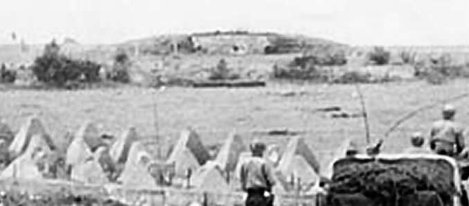
Zoomed in picture of the 'hill'
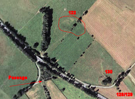
The hill is in fact a pillbox, surrounded by dirt at both sides and on top.
I'm almost sure it must be pillbox # 122, which was a type D-2 Dreischartenstand
MG pillbox. This was a pillbox with three embrasures for MG 34 machine guns.
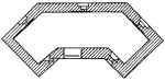
Regelbau D-2 Pillbox