
-
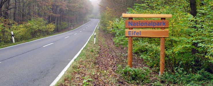
National Park Eifel.
-
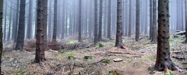
Misty forest.
-
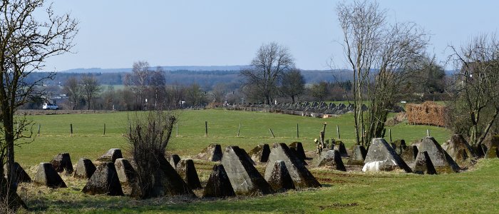
Dragons Teeth at Schmithof.
-
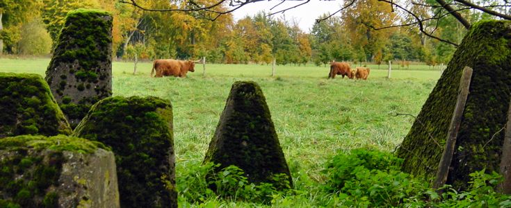
Cows grazing in between the dragons teeth.
-
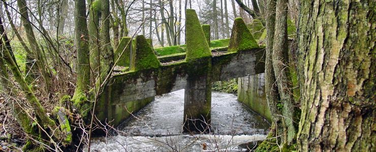
Dragons teeth spanning the Grolisbach creek north of Roetgen.
-
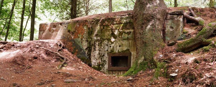
Pillbox #131 in the Buhlert woods.
-
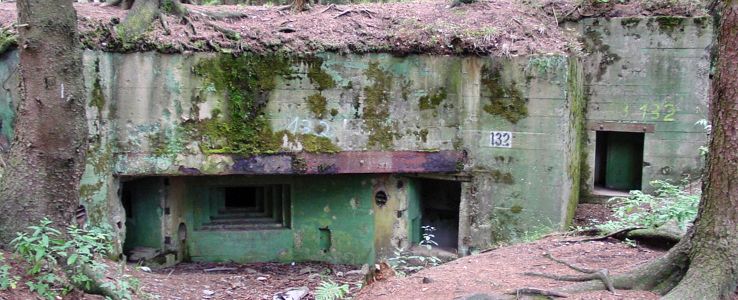
Pillbox #132 in the Buhlert woods.
-
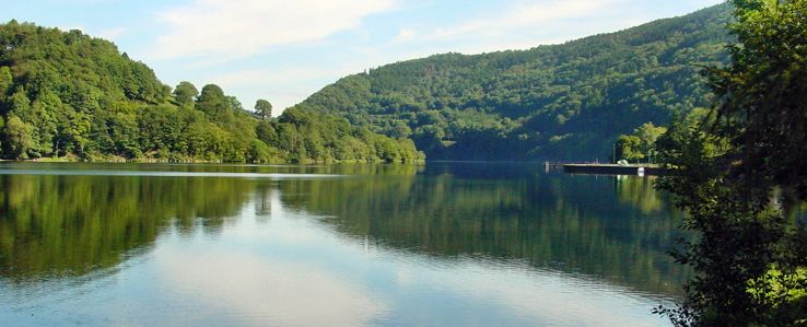
Obersee at Einruhr.
-
Roer River at Heimbach.
-
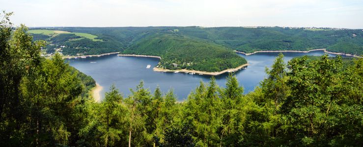
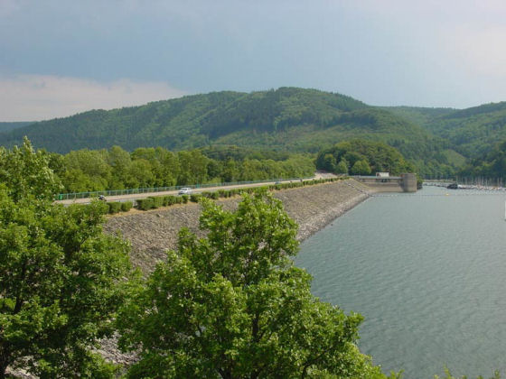
Schwammenauel Reservoir.
-
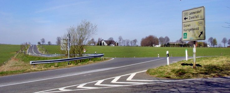
Raffelsbrand Road Junction.
-
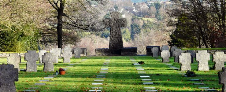
Ehrenfriedhof Vossenack Cemetery.
-
Simonskall.
-
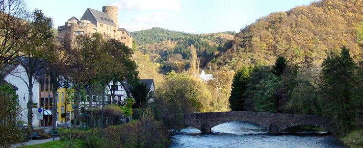
Vossenack.
The Battle of the Huertgen Forest (German: Schlacht im Hurtgenwald) is the name given to the series of fierce battles fought between U.S. and German forces during World War II in the Hurtgenwald. It became the longest battle on German ground during World War II, and the longest single battle the U.S. Army has ever fought in its history. The battles took place between September 13, 1944, and February 10, 1945.
The Huertgen Forest (Ernest Hemingway called it 'Passchendaele with tree bursts') covers approximately 50 square miles (130 km2), from Aachen to Düren to Monschau near Germany's western border.
The towns of Stolberg to the northwest, Düren to the northeast, Roetgen to the southwest, Schmidt and the Schwammenauel Dam formed the corners of the battlefield. (Interactive Photo Map of the Huertgen Forest Area).
As the northernmost part of the mountainous Eifel region, it's one big wooded plateau, sliced into ridges by numerous streams.
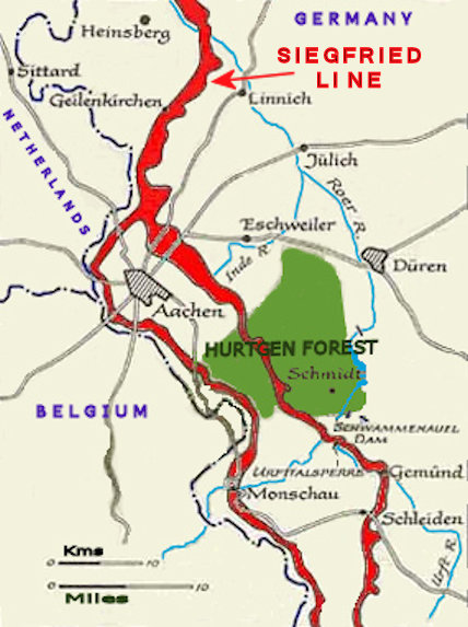
From a point north of Aachen to south of the Hürtgen Forest, the Siegfried Line is divided into two separate belts, the Scharnhorst Line and the Schill Line.
Holding this part of the front of Generalfeldmarschall Walter Model's Heeresgruppe B was the 7. Armee, led by General Brandenberger.
The Germans stubbornly defended the forest for four reasons.
Firstly, the difficulties of its terrain made it ideal for defence by a small but resolute force; secondly, its position along the Belgian-German border offered an opportunity to block further enemy advance into Heimat territory; thirdly, unlike the Allies, the German High Command was acutely aware of the importance of the Roer Dams and holding on to them played a predominant role in their thinking; and fourthly, delaying the enemy west of the Roer was essential for gaining the time needed for the massive build-up behind that river for the great Ardennes counteroffensive which was planned for December.
In the winter of 1944-45 thirty thousand American GI's were killed or wounded in the longest battle ever fought by the U.S. Army, the little known Battle for Huertgen Forest. From September 1944 to February 1945 eight U.S. infantry and two U.S. armored divisions were thrown into the “green hell of Huertgen” or “Death Factory”, fifty square miles of thick, rugged hilly woods, full of German soldiers in a deadly network of bunkers and fortified positions. In the dense forest of fir trees, with limited visibility, death could come from any direction.
In contrast with The Battle of the Bulge, little is known about The Battle of the Huertgen Forest.

(0 0)
+----------o00-(_)-00o----------+
Scorpio's Website
|__|__|
|| ||